Mastodon

We're looking for the trash fence...

How to pickup a mooring ball in Avalon

Posted on Sun 16 October 2011 in Destinations

First sail three nights, mostly motoring and arrive on diesel vapors.

Second, hail the Avalon Harbormaster. They will meet you out front of the bay in a run about. They will need cash, on the spot!

Then go to the fuel dock by winding your way all over the mooring ball field so you can get a port side tie.

Then come back out and head for your assigned mooring ball. Here were the instructions:

  1. Go over past that large tourist boat turn right and go down till your 5 rows from the shore
  2. Turn right at mooring ball 174
  3. Go down to 182
  4. Grab the stick for the bow line, pull that up and put it on your bow cleat
  5. Walk the line leading astern hand over hand and pull up the stern line and cleat it off

Here’s how it actually goes

  1. Go 5 rows from the shore. Five rows from the shore… how the hell do we count those rows that are blur of mooring balls from the shore… we’re approaching from the ocean… red right re-whatTF
  2. Oh shit a yellow submarine (srsly!!), hard to starboard, quick turn turn right at mooring ball 174, shit, the guy in 174 has his boat sitting so far aft that he’s blocking the fairway, SOB!
  3. Go down the next row and weave between bouys and back up to your row, go down to 182. Its obvious which one it is. 182 is the only ball between two boats, the others are wide open, but you need 182.
  4. Grab the stick for the bow line, oops not close enough… reverse… ah shit we’re sideways.. abort abort!!!
  5. Go around and come back in as you did before and this time grab the stick for the bow line… holy mother of mooring balls this thing weights a friggin’ ton! Run up help Dawn. Just tie whatever line you have in your hand to your bow cleat.
  6. Walk the slimy stinky very slippery hard to pull line leading astern hand over hand and pull with everything you’ve got because now your sideways again and no on is driving. Quick run and back down a little and pivot the stern. Now go back to the bow and heave that line along your starboard rail. Put the damn thing on your jib sheet which and both of you grind that bad boy in.. whew at least we’re straight in the slip almost cleated off and sweaty and stinky.
  7. Now cleat all the lines off correctly
  8. Chat with neighbors who provded moral support while in fear of you smashing into their power yachts.
  9. Shower
  10. Drink Wine
  11. Write Blog Post
  12. Revel in the memories of another no-harm no-fail docking\mooring experience!

AvalonRoute

This track line from Coastal explorer is seriously just a summary line we were all over the place!


Santa Catalina island

Posted on Sun 16 October 2011 in Uncategorized

20111016-095046.jpg

We are about half way round the island and on our way to Avalon. Just a couple more hours then some rest and then on to San Diego, which is German for....


Santa Cruz Island

Posted on Sat 15 October 2011 in Uncategorized

We are safely around pt concepcion, passing Santa Cruz Island and headed for Avalon! It's 64 and sunny... Yay!


Noyo River–Fort Brag, CA

Posted on Mon 10 October 2011 in Destinations

Noyo river bar looking west

This shot of the Noyo River Bar looking West shows the narrow 90 foot wide entrance to the river. We had read that this was a difficult and possibly dangerous crossing that should only be undertaken in calm seas. After we had motored around Cape Mendecino in NOT calm seas we knew we could make this harbor in the daylight, which would be a new experience for us. We’d crossed all the other bars thus far in fog and at night. This would be easy.

I hailed the USCG they had an hours old bar report which said it was calm. it was foggy as we approached, they suggested we wait till high tide (2 hours) since the controlling depth (the low depth) in the channel is 6 feet 7 inches!! (we draw 6 feet). So with 2+ fathoms (12+ feet) uner our keel we crossed and headed for the Transient dock at Noyo Basin Moorage as drawn up in Charlie’s Chart. It was Sunday and no one was around and there was no contact info at the office so we just grabbed the “transient dock” and went for a walk around.

A few hours later the weekend guy from the marina says we have to move our boat because this slip is for a big 80’ fishing boat. “OK. Where should we go?”, we asked. “I don’t know, but you can’t stay here!”, was the reply. The weekend guy was a total jerk basically. Dawn was about to kill the guy! We had talked to Theo and Marion from sv Marionetta (who met up the coast) as we were on our walk and knew that they and sv Celtic Song were tied up on the other side of the river to the dock at Carine’s Fish Grotto. Since the guy from the Port was not helpful and had no suggestions, I call the restaurant and the Owner goes out and asks the two boats if we can tie to them! Celtic Song says no problem and we maneuver over and side tie to them. Whew, crises averted!

The backstory to that is that the marina lost 20+ slips in the surge from the recent Tsunami, so they were really short on slips. However that night sv Ventured came in (at night yikes!) and found a slip… so go figure.

There were several boats holed up waiting for the weather and to make repairs so we had a meetup at El Mexicano. I of course failed to take a photo, but here’s a list of boats in attendance.

  • sv Celtic Song – heading to San Diego, had to come in to repair a muffler
  • mv Chinatsu  - Heading South. They stop every day so the dogs can get off.
  • sv Deep Playa – Who knows what they are doing… Winking smile
  • sv Marionetta – They are going to be in Noyo for a few weeks as they are waiting on a transmission to be shipped from England.
  • sv Ventured – Another Seattle boat headed for the Baja Ha-Ha who we are hanging with at Monterey now. Good peeps!

The river is very narrow and windy and lined with wharfs on one side for the buildings that support the fishing boats. I thought it looked like the town in the Movie Popeye. But now that I googled that, it looks like my memory of the movie more than the actual movie. It was cool looking (and I didn’t take any pics!). However, it did rain a ton and we had to clean up some mold in the v-berth and get out the fans to keep the air moving, but all in all, it was a great place to spend a few days with all of the things we needed within a 1 or 2 mile walk away. Aside from the idiot at the Marina the people there were very nice!

We are now in Monterey taking pics of everything and waiting for the next window to jump down to San Simeon, Morro Bay, or San Luis Obispo which are North of Point Concepcion or maybe make it around the “Cape Horn of the Pacific NW” to the northern Channel Islands. All TBD as the weather is getting crappy again.. We’re going to do some projects here since its looking like our time in San Diego prior to the Ha-Ha will be limited.


MPPT Solar Charge Controller Comparisons

Posted on Tue 27 September 2011 in Pearson 424

I made another of my feature comparison spreadsheets this time comparing the features and prices of MPPT Controllers. ~You can see the MPPT Solar Charge Controller Comparisons on SKyDrive. I always use SkyDrive with IE.~

NOTE: Link lost due to bit rot.

Here’s a little sample of the data

Make Model Price Google Shopping Max PV Watts (12V)
Morningstar Sunsaver MPPT 199.00 200
Morningstar TriStar MPPT 45 390.00 600
Morningstar TriStar MPPT 60 478.00 800
Outback Power FlexMax 60 520.00 900
Outback Power FlexMax 80 599.00 1250
Blue Sky Electric Solar Boost 2000E 258.00 350
Blue Sky Electric Solar Boost 50L 407.00 700
Blue Sky Electric Solar Boost 3048L 456.00
Blue Sky Electric Solar Boost 3024iL 334.00 540
Blue Sky Electric Solar Boost 1524iX 222.00 270
Blue Sky Electric Solar Boost 2512i 198.00 350
Blue Sky Electric Solar Boost 2512iX 197.00 350

And here is the timing issue…

Posted on Mon 26 September 2011 in Systems - Electrical

I figured out why the ACR didn’t flip to combined in time… right out of the documentation:

Blue Sea Systems CL-Series BatteryLink ACR PN7600 Owner’s Manuual

Internal time delay prevents relay action for transient conditions, voltage must be within range for approximately one minute to cause closure, relay will open when overvoltage is detected for approximately 15 seconds.

The regulator definitely went from an acceptable charging voltage to an overvoltage situation in less than a minute.


Overcharging Problems

Posted on Mon 26 September 2011 in Systems - Electrical

WiringDiagramExplanation

(CLICK GRAPHIC TO ENLARGE)

Not sure most of you will want to read this, but to my fellow boaters here goes…

When we had the engine out of the boat to replace the fuel tank we also decided to upgrade our alternator from a 65Amp model to a 100Amp model and to add a Balmar MC614 three-stage external regulator to increase our engine based charging capacity. We also made changes to our battery configuration. We combined all of our existing batteries into one 660Amp Hour (Ah) bank instead of two banks of 440Ah and 220Ah. We also added a single dedicated 12V starting battery.

Our starter is wired to the dedicated starting battery and the alternator charges this battery first. When there is charge being supplied to this battery our Blue Sea 7600 Automatic Charge Relay (ACR) combines the house and starting batteries so the alternator now charges all the batteries. In order for the Balmar external regulator to control the alternator output properly it monitors the voltage of the batteries it is charging (see 1 above). The problem we experienced was our starting battery was being overcharged so much it started to boil the water off. Here is what we think happened.

The two key components in this are where the 12V Sensor wire (1 in the drawing) is attached, 2 the house bank or 3 the starting battery and whether the ACR has the batteries combined or not.

Originally we (myself and our experts) believed the 12V sensor wire could go on either bank since we believed when the ACR saw a charge voltage it would combine the batteries, the regulator would then see the combined voltage of all the batteries and adjust the output of the alternator accordingly. We had the 12V sensor wire attached to the House Bank (2).

We still think that at some lever we’re correct in our assumption, however we now believe there is a race condition where the following happens:

  1. The Batteries are isolated because the house bank is not at full charge (Undervoltage on the ACR)
  2. The Engine starts and the regulator is responding to the low voltage on the sensor wire on the house bank (2). It then tells the alternator to  output more power
  3. The ACR can’t “see” the additional power from the alternator because the batteries are not combined so it tells the alternator to output MORE power.
  4. Now the ACR wakes up (or its sample frequency is less than the regulator) and it sees too much current on the Starting battery and now does not combine the batteries because there is an Overvoltage situation on the starting battery.

The basic problem was the ACR didn’t combine and the regulator was getting mixed signals by monitoring a bank that was not being charged, since the ACR did not combine, while simultaneously charging the hell out of our starting battery. We believe this is what was happening at sea. We know for sure we have reproduced this at the dock.

In order to eliminate this we moved the 12V sensor wire from the house bank to the starting battery. Now regardless of if the ACR combines the battery banks or not at least the regulator is monitoring the voltage of the battery is charging when the ACR has the two banks isolated.

We tested this today and we were not able to get the regulator into an overcharge state. We’re going to test a few more times over the next few days. We’re also going to contact Balmar on Monday and Monty at Englund Marine is going to contact Blue Sea Systems to confirm what we believed happened and that our fix is correct and also just to check to see if they already know something about this happening before.

Another day another thing learned…. ya gotta love it! (DISCLAIMER: We’d love it a lot more if it weren’t foggy and rainy)


Weather 4D HD Now Has WAVES !!!

Posted on Sat 24 September 2011 in Weather

As promised V1.2 is available in the App Store and it supports WAVES allowing you see the height, direction and period of forecasted waves… It’s just plane awesome and its now my favorite weather app on the iPAD!!

You can see screen shots of the new version on Weather4D’s web site http://www.weather4d.com/news (French)  http://www.weather4d.com/en/news (English)

If you have an iPhone or an iPad buy Weather 4D HD now!!


iPAD Weather Apps Review

Posted on Fri 23 September 2011 in Geek

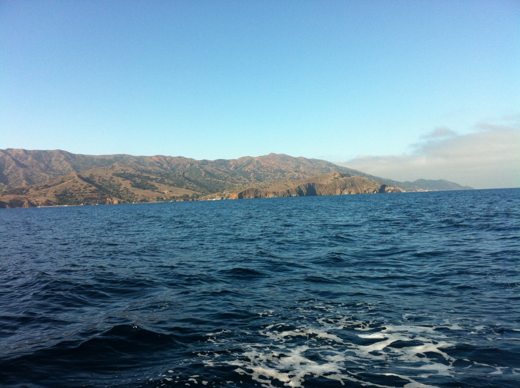
We’re back in planning mode and waiting for a weather window in Charleston to jump down to San Francisco which made for a perfect opportunity to play around with weather Apps for the iPad.

A first rate weather application should allow you to see both wind and sea state information simultaneously. Air Temp, Water Temp, Cloud Cover, Precipitation are nice but not super critical for my needs, but may be for others. I’ll first go over some of the common functionality of these applications and then review how each app did at implementation.

All of the apps use public weather data either directly from NOAA, Saildocs or some other such relay service. If you’re familiar with receiving GRIB files through SSB or the web then you will be familiar with the way they are visualized in the apps. Each app adds a lot to the presentation of the data and making it easier to understand. Some of the apps support more than one data model (read about the GRIB data models on SailDocs). Since I don’t have a ton of experience interpreting data models, I am unsure which data model is better than the other or which is better suited for which route planning. It would be useful to look at more than one data model to see if and where they differ. The assumption that agreement between data models means a higher likelihood that the forecasted conditions are what you’ll actually see out there.

All of the apps allow you to visually select the area of the forecast model by selecting an area on a map. Additional selection information includes the following options: forecast to retrieve (and hence the file size), number of days in the forecast, number of forecasts per day, and the weather data to be retrieved (wind, wave, temps, cloud cover, precipitation, etc.). After selecting the data you want to include the GRIB file is then downloaded by the application.

All of the applications have the ability to play, or animate, the multi-day forecasts. This is similar to watching a time-lapse RADAR image on the web or on the local TV news, but in this case it shows the evolution of the forecast in your selected area.

Keeping the above information in mind and the disclaimer that I am at best an amateur neophyte weather forecaster, here are my reviews of the following applications.

WeatherTrack (iTunes) only allows you to see one weather data model at a time. Animating the data requires an extra step after download and there is some pause while it is generated. The other apps generate animations on the fly or by default; in this case the extra step makes the implementation feel less polished.

Weather 4D HD (iTunes) has some stunning graphics and not only are they are sexy, you can understand more information faster. With a two finger tap on the screen controls can be accessed that allow you to change the information displayed. For example, you can choose to mask forecast data over the land (or water) so it is hidden. You can also change wind display visualization from traditional wind barbs to color gradients. This can also be done for temperature data. Another nice feature allows you to visually display sunrise and sunsets data by changing the background display map from day to night making it obvious to tell if you’re looking at a day time part of the forecast or a night time forecast. This is VERY intuitive and when you’re trying to plan a multi-day passage it again makes understanding what will be happening at day or night on your projected route more obvious because you are visually prompted to see the end of each day.

This is by far the best app due to its visualization and its ease of use. However, it only supports the NOAA GFS Model which does not contain sea state information, which as I mentioned earlier was a must-have feature.

NOTE: I have spoken with the author of Weather 4D HD and he told me he just submitted an update which does include wave data. YAY!! I’ll update this review when I have actually used it.

PocketGrib (iTunes) is the only application that currently displays multiple types of data and does contain sea state information. Visually it is not as sexy as Weather 4D HD, but it is functional. Some things need work, like the date selection on the bottom takes all of the real estate on the screen and thus covers up the icons legend. This is especially problematic since I had a hard time deciphering the different sea state icon sizes. The red sea state icons are like carrots (or arrows) of differing sizes based on height pointing in the direction of the wave\swell. I don’t find the sizes of the icons to be considerably different. So if you have three icons represent three states the one in the middle isn’t different enough from the one above or below. Adding color gradients, wave gradient height would help, or even better, providing the option for both.

PocketGrib only supports one data model and the file name indicates it’s a GFS model. However, GFS models don’t contain sea state information. I contacted the author and they are merging in WW3 data, but don’t mention it. Probably not a big deal to an average user, but I think they miss out on getting credit for it.

Of the apps that I reviewed, PocketGrib is the only application that meets my primary requirements to allow me to visualize both wind and sea state information simultaneously. I am selecting it to use for future passage planning. Since I really liked Weather 4D HD, I will be using it when I in port and want to see normal land lubber weather.

I’m stoked for the new version of Weather 4D HD to come out, I keep checking for app updates looks like that will have to wait till we’re further down the coast.


NMEA Data Sharing Across Applications and Platforms

Posted on Fri 23 September 2011 in Coastal Explorer

Systems - Electronics Slug: nmea-data-sharing-across-applications-and-platforms Status: published

With a Maretron USB100 NMEA-0183 Gateway and an Actisense NGT-1 NMEA 2000 gateway I was struggling to get the NMEA data to all the applications on my PC, iPAD and iPhone. Many applications can not only connect to the an NMEA data source but also share the data on another TP Port or Virtual Com Port. Originally I was using a complicated stack of software all connected to each other to get data to some of the applications but couldn’t really use them all at once. More importantly which ever app I felt like using at the time might require starting up two applications!

Well in comes GPSGate Client (\$40) which lets you connect to a data source and then share it with many other applications.

You can see in the graphic below that I’ve dedicated the Actisense Gateway to Coastal Explorer. GPSGate is then connected to the Maretron Gateway and then it is used to serve up the data to 7 other applications some on Windows and some on my WiFi iPad and iPhone.

Also of note is that my preferred iOS navigation application Navionics works fine on the iPhone since it has a built-in GPS, but on the WiFi iPad there’s no way to get the NMEA data into the application. I’ve contacted Navionics about this and we’ll see if they add the functionality.

NMEA Data Sharing

This is greatly simplified from the way I was doing it before and I’m very excited to not only have all this finally working but to have it working simply! \$40 for GPSGate was worth every penny!